Research Interests
Applications of Geographic Information Systems and geospatial big data in environmental monitoring
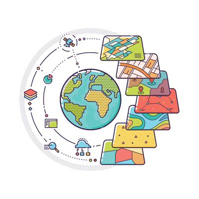
Geomatics, which includes geographic information systems and remote sensing, has the potential to identify and analyze spatial patterns and processes of various environmental issues. For example, it can be used to monitor crop conditions, track deforestation and desertification, and assess eutrophication. Picture source: https://www.frontiersin.org/research-topics/8127/big-spatial-data
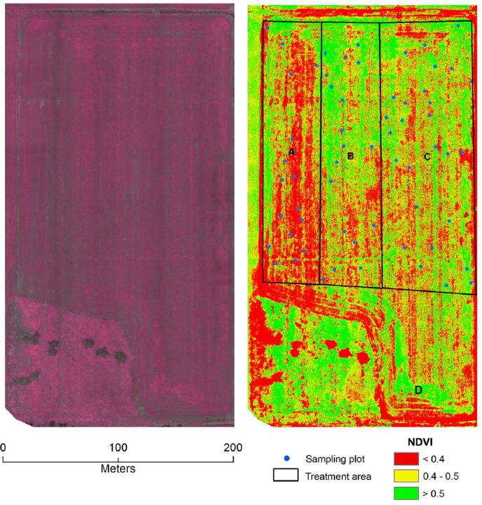
Applications of drone images in precision farming
Drone technology, also known as unmanned aerial systems (UAS), has found significant use in precision agriculture due to its cost-effectiveness and ability to acquire data with flexibility. The picture on the right is a mosaicked image map based on UAS images of a soybean field in Sturgeon Falls, ON, Canada taken on July 12, 2013. The A, B, and C represent treatment areas of organic only, organic and chemical fertilizer and chemical fertilizer only applications, respectively. The final yields for the treatment areas A, B and C were calculated at 1.73, 2.27 and 2.97 tons/ha, respectively.
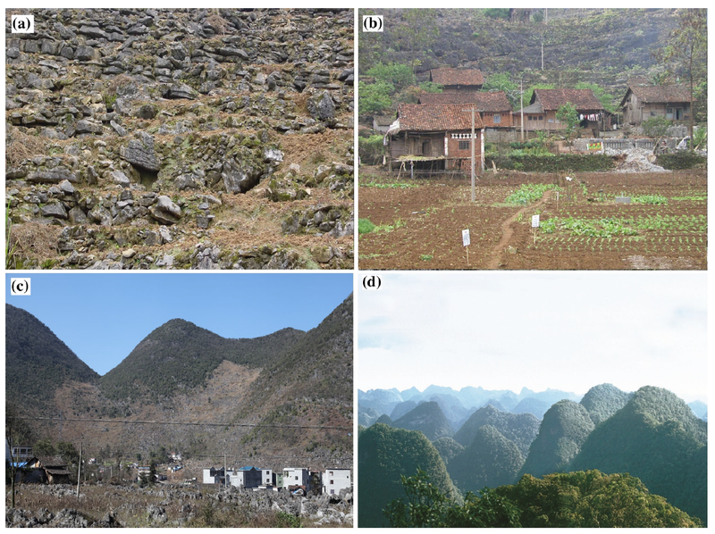
Landscape Science
Landscape science is a discipline that incorporates field studies, remotely sensed imagery, and modeling to analyze past landscape changes, forecast future changes, and assess their impact on ecosystem services. Images on the left show typical karst landscapes. (a) A desertified slope in Huanjiang, Guangxi (Imaging date: January 15, 2002), (b) a typical Maolan (minority) village in Huanjiang, Guangxi (Imaging date: March 25, 2003), (c) typical land use pattern in a peak-cluster (fengcong) depression (Imaging date: January 24, 2018), (d) Mulun National Reserve (Guangxi) (Imaging date: November 9, 2007)
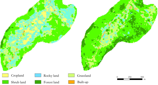
Landscape Science
Land cover change is an important proxy for environmental changes. The picture on the right shows land cover changes (recovery) in a karst depression, Southwest China between 2004 (left) and 2019 (right)
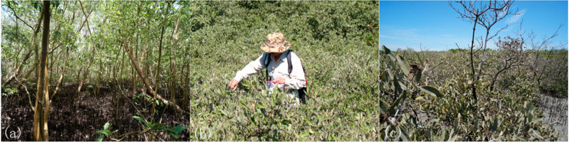
Environmental Degradation
Multiple ecosystems are experiencing degradation due to various stressors.The picture features mangrove forests with different conditions. (a) healthy black mangrove (Avicennia germinans), (b) dwarf black mangrove, (c) poor condition black mangrove.
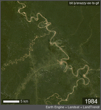
Environmental Dynamics
Utilizing historical geospatial big data can help identify environmental dynamics. This animation indicates dynamics of the channels of Ucayali River, Peru between 1984 and 2022 (Landsat images)